Showing posts with label Hawstead. Show all posts

Thursday, June 03, 2010

A cycle ride to Hawstead Suffolk

Share
Another early morning start. There was a clear blue sky and it was already warm at 8am as I set off for Nowton. I went past Nowton Park and the church at Nowton before reaching Hawstead. Here there is a big open green with wild flowers and an overgrown football field.

From this point there was a long climb up Bell Lane, the road twisting and turning but I climbed up this fairly well making use of the 15 gears. My bike is old and heavy but it is doing the job for me filling in as a temporary means of providing me some exercise and site seeing around Suffolk.

I returned home through Nowton Park where there wasn't a sole to be seen.

Today I did 11 miles for a total of 49 miles this week so far. It was also day 3 of Juneathon and this was another motivation to get out on the bike.

Friday, May 21, 2010

A cycle trip to Hartest Suffolk

Share
This was a lovely sunny lunch time cycle ride out to the village of Hartest. With the weather being so good I was keen to get back on the bike and go for a spin whilst I am unable to run.

What I am finding is that cycling requires a little more pre planning on a route to follow - firstly to avoid any of the major roads and secondly because in the space of an hour or two you can go a lot further in distance and need to ensure your route takes you back home and not leave you 20 miles away. I like maps and have a number of the ordnance survey explorer maps of Suffolk which have a scale of 2.5 inches to a mile. The map I use most often is the Explorer 211 for the Bury St Edmunds and Stowmarket area which shows all of the public rights of way and paths and walkways.

The route I decided on was Bury St Edmunds / Nowton/ Hawstead/ Lawshall/Hartest/Brockley Green/Whepstead and back to Bury

The saddle soreness was immediately noticeable when I got on the bike today but is no big deal and was soon forgotten once I had gone a mile or two. After 3 miles when I reached Nowton there was very little traffic. From Lawshall I took a turning along Hartest Lane which was a narrow minor road which was pretty much a down hill section for nearly 2 miles.

Hartest green was around 10 miles in to the ride and the ideal place for a short stop for a drink and a banana and to take a few photos. Hartest is part of Suffolk which is little more hilly than most and is an area known as High Suffolk. I came down Hartest Hill into the village and I think this may be one of the steepest hills in Suffolk. Surrounding Hartest green are many bright coloured cottages. As with virtually every village there is a war memorial to commemorate those from the village who died in the 1st and 2nd world war the memorial was unveiled by Capt. E H W Backhouse on 24th October 1920, it cost £20.


My return to Bury was along the Brockley Road and here between Brockley and Whepstead there was a yellow carpet of oil seed rape fields.Extra Virgin Rapeseed Oil is said to be possibly the healthiest and most versatile cooking oil you can get.

My cycle ride totalled 18 miles in 1 hr 40 Min's. I was about 10 seconds a mile quicker than on Wednesday.


Sunday, March 07, 2010

Long Run to Lawshall Suffolk

Share
The end of my 9th week of training for a half marathon called for a 13 miler. Luckily once again the weather was ideal for running, bright blue skies and no wind. At the same time it was cold and the overnight frost had left intricate patterns on the cars and made for some icy patches on the wet roads first thing this morning.

As my long run extends I am travelling further afield and my route today took me to Lawshall via Horsecroft, Pinford End, and Hawstead. The route was on road all of the way but I rarely saw any cars and was untroubled.
The church here is St Andrews at Hawstead , a sprawling village 

After my temp run on Friday I was a little stiff still and with the cool air took a while to get going. I think I could have done with having something to eat before running this sort of distance but as I was running by about 7.45am I didn't apart from a cup of tea and plenty of water. I took with me some Powerbar Ride Shots as the name suggests I think they are designed for cyclists but are designed for high intensity exercise. The blurb on the pack suggests :-

They're formulated with PowerBar C2MAX dual source energy blend for more energy to muscles. In fact, C2MAX was designed to have the same blend of energy sources that were shown in breakthrough studies to deliver 20�55% more energy than glucose alone, and in another study to improve athletes' cycling times by 8%. 

I bought them at the new Holland and Barrett health food store in Bury St Edmunds . I took 3 of these on my run and realised after wards that these are not for vegetarians so I will ditch the rest of them. A little hard to say based on one usage whether they provided an energy boost. The problem was I didn't have anyway water with me and without the the lemon flavour was sticky sweet. As an experiment  I will try something different for my next long run. I guess armed with a drink these may work for you.


My mile splits today were 8.55,9.28,8.54,8.37,8.49,9.01,8.38,8.33,8.27,9.10,8.43,8.31 and 9.38


The route was generally climbing on the way out and more downhill on the way back apart from the final mile which has 3 stiff climbs.

My total time for the 13 miles was 1hr 55mins and 28 secs. Happy with this. Not quick but main thing was the confidence gained from competing this. I know that I should be able to complete the half marathon at the end of March as long as I am healthy and not injured. Whether I can run any quicker will depend on the course , the weather and my state of mind.


Looking at my running log the last time I ran this far was when I ran the Stowmarket Half Marathon on the 29th March 2009 in 1.45.37


The Metcalfe Arms at Hawstead Suffolk is a real ale pub and consequently has a listing on CAMRA the campaign for real ale. There is a Metcalfe Society which is a one name geneology study site.

There were plenty of snowdrops on the banks of the road this morning, they are a flower that we have never been able to get to grow in our garden

On this route you pass an old school house which is a now a private residence.
This monument at Lawshall commerates Flight Sergeant Johannes Bartholomeus Jat Van Mesdag of No 64 Squadron who aged 21 whilst flying his Mustang Mk 111 lost his life on the 6th March 1945 near this spot on his Mothers birthday. The statue was erected in November 2009.


I haven't been able to find to much about this pilot but presume he may have been based at the Suffolk airforce based at Bentwaters.

Apparently these planes were named as P-51's in the US . 

The statue had fresh flowers.

Saturday, August 18, 2007

Pinford End Suffolk

Share
8am 7.5 miles in 1 hr 2 mins 24 secs
Week to date mileage 30 miles
Month to date mileage 85

Average weekly rate 30.1 miles
Average monthly rate 131
Year to date 990
Lifetime 10583

A wet blowy morning as I decided to run out and back to the small hamlet called Pinford End which is really one end of Hawstead village. I take the Horsecroft road near by the busy traffic lights at the Spread Eagle and run up hill out of Bury.


Running out of Bury you pass Hardwick House and Horsecroft Hall. At Hawstead Lodge there is a large hill which takes you down to Pinford End. This was my half way point and I turned in 31.32.

Returning by the same route I took 30.52 though there are 2 large hills to climb the route is generally downhill on the return.

Tuesday, June 12, 2007

Hawstead Suffolk

Share

5pm 6 miles in 50 mins 16 mins
Week to date mileage 6 miles

Month to date mileage 62

Average weekly rate 29.8 miles
Average monthly rate 129
Year to date 693

Lifetime 10286

Hawstead the place of shelter for cattle according to Ekwall. This was my starting point for today. Hawstead is a small village about 3 miles south of Bury. Instead of the hurley burley of the A 134 Bury to Sudbury road give this road a go but allow extra time. If you follow the road out by Nowton Park you can pass through Hawstead, Lawshall and Shimpling and join up on the A134 around Alpheton - makes a pleasant change.

I parked at the totally deserted Hawstead Green next to the playground. An entertaining game of football could be held here in the long grass. It looks as if the village has achieved its target for raising funds for a village hall not sure when or where this will be built.

I decided to head out on the Lawshall Road past the fine pub the Metcalfe Arms.

Along the Lawshall Road near the Newhall Farm there is a marking on the OS Map Explorer 211 which simply says Oak! I must admit I didn't particularly notice which oak this might be but why even mention unless there is some historical reason. I managed to find out that traveling clergymen used to stop at the Gospel Oak to say a prayer perhaps when on a trip to the monastery at Bury St Edmunds. I did see a very old tree which was much the worse for wear but didn't take a photo so know I will have to revisit.

The road here is windy and undulating and can be a little busy. So I turned off at the first footpath that I could which was just beyond the Gospel Oak. Here the footpath was along a car track which had obviously been wet but had now dried to form ridges. Running along here was challenging either balancing on the top of ridges or sinking in the centre of the tyre tracks. However the first section was under tress offering some shade from the warm sunshine. I manged to startle some deer but didn't have time to catch them on camera.

I was soon running through the middle of a wheat field taking me downhill before passing a spring and then heading sharply up hill and emerging at Old Lane Stanningfield Little Rookwood Farm. This area was a Catholic stronghold and the home of Ambrose Rookwood who was one of the conspirators in the Gunpowder Plot in 1605. He was hung drawn and quartered.

I returned back to Hawstead by the same paths. In Hawstead I did a few laps of the wonderful village green. Once again I had the entire run to myself and never saw another person on the run.

Wednesday, May 30, 2007

Lawshall Suffolk

Share


5pm 6.2 miles in 52 mins 1 secs

Week to date mileage 14 miles

Month to date mileage 117

Average weekly rate 29.5 miles

Average monthly rate 128

Year to date 631

Lifetime 10224

On the Bury to Sudbury road beyond Bradfield Combust along the roman road there is a turning for Lawshall. Initially you pass a number of greens including Lawshall, Hib's and Hanningfields before reaching the village of Lawshall. I parked up near the Swan Pub.

The weather was a mixture of sunshine and showers more April than late May and not warm. Lawshall has just held its annual scarecrow festival in aid of its village hall. This was the only 1 of the 19 or so scarecrows which were on display last weekend.

As per usual I didn't really have a plan of where I was going to run. I went through Harrow Green and past Our Lady Immaculate and St Joseph Church which sits not far from the gates to the western entrance to Coldham Hall.

There is a public right of way here that takes you up the hall and than on to Stanningfield where you can return to Lawshall along Donkey Lane. However I decided on this occasion to continue on along the road to Hawstead which was probably not the wisest choice. The road was lovely and windy and fairly hilly up and down. However it being rush hour there were a number of cars virtually all seemed to be Range Rovers.

I turned somewhere near Upper Dutmoss Wood and retraced my steps back to Lawshall. Entering the village this way All Saints Church looks more commanding.

The old Post Office is now a private residence but is still signed.

Sunday, April 22, 2007

Hawstead Suffolk

Share
8am 9.8 miles in 1 hr 21 mins 31 seconds

Week to date mileage 33 miles

Month to date mileage 96

Year to date 487

Lifetime 10080

Saturday, August 05, 2006

Hawstead Circular Run Suffolk

Share
8am 9.4 miles in 1 hr 17 mins 26 secs

Week to date mileage 22

Month to date mileage 22

Average weekly rate 31.6

AverageMonthly rate 137

Year to Date 980

Life time 8758

Felt good as I set of on this circular run which has to be one of the most challenging runs I do. It is to say the least undulating with some good hill climbs. It is probably why it is emerging as one of my favourite regular runs as it presents a challenge whilst providing some wonderful scenery and takes you through the villages of Horsecroft, Pinford End,Hawstead and Nowton.

I am going to try and capture an almost step by step guide to this run over the next few weeks and here is my first attempt:-

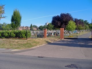
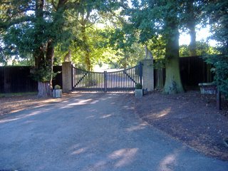
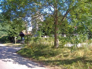
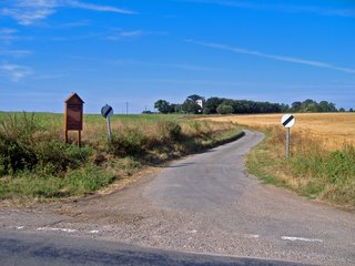
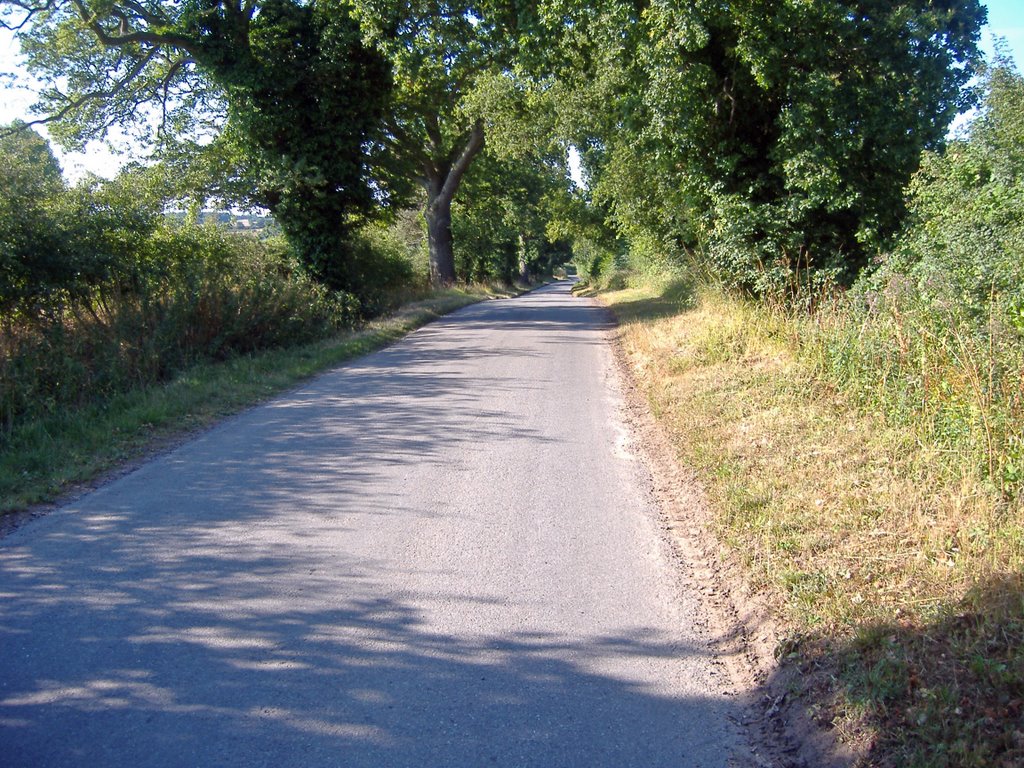
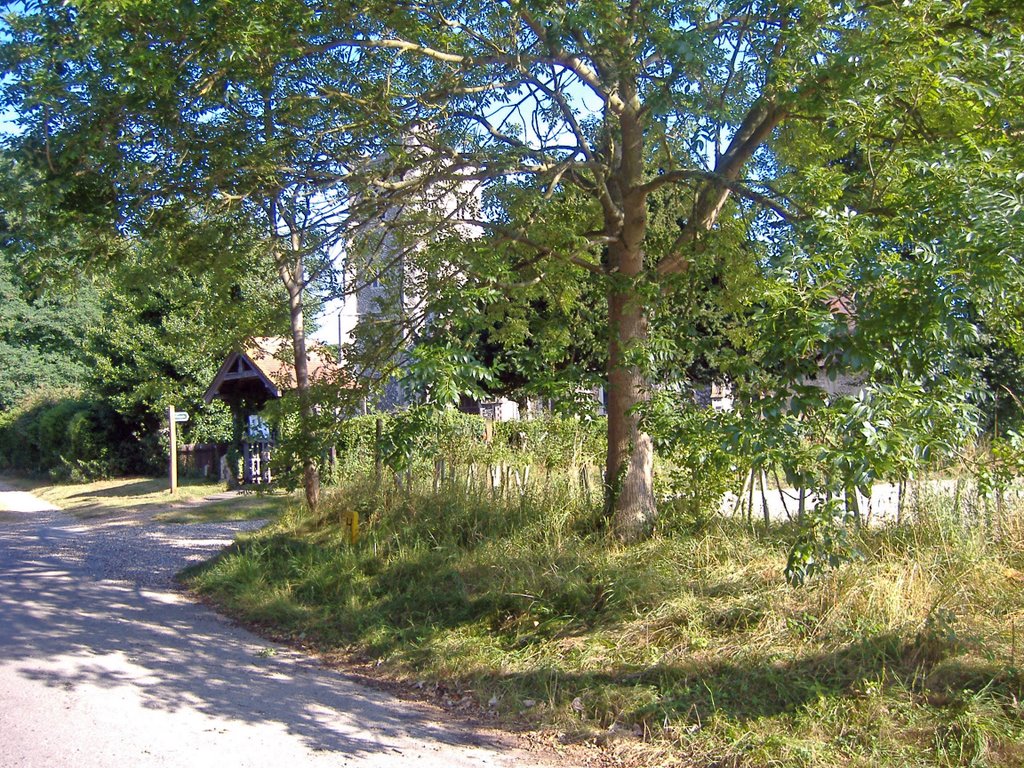
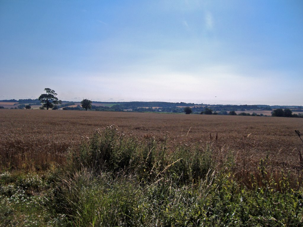
Without a GPS device I have estimated the distance as best I can, though I am sure it is slightly out and depends on the starting point which for me isn't far from Westly Road and the Water Tower visible at the top of this picture. So an easy start takes you down West Rd besides the cemetery. I then run along Hospital Rd.


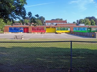
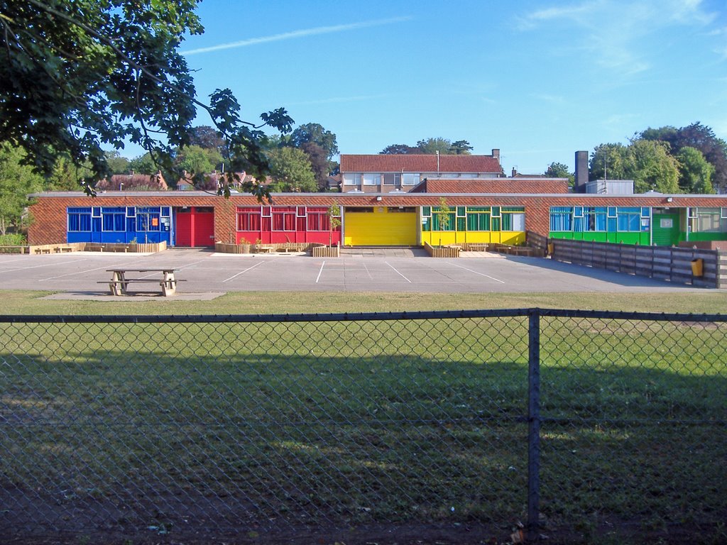
I then take a right turn towards Westgarth Gardens before turning left to run past Westgate School which seems to have been painted in good bright "house form " colours? Nice idea Mr Lee if you are still the Headmaster.


You soon emerge at the Spread Eagle Pub and here I cross over the main road and turn right up Horsecroft Road and it is quite steep to begin with as you climb out of Bury. This house near Stonebridge Farm is really the point when you emerge out of Bury but continue straight along the Horsecroft Road. This short section of road is probably the busiest of the whole run but nothing to make you fearful.


As you run along the Horsecroft Road to the left is the large Hardwick Manor and the grounds surrounding the West Suffolk Hospital. On the road you soon see on your right a sign to Horsecroft Hall. Ignore this and keep going unless you are a VIP as this is private.


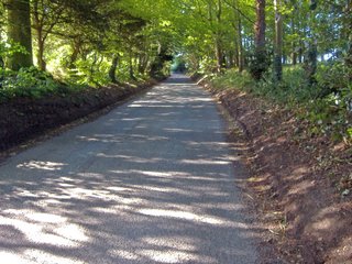
Almost immediately to the left is an entrance to Hardwick Game Farm with some large stone dog columns guarding the entrance. This section of the run is wooded providing a canopy to hide from the sun on hot days. You are pretty much still running up a slight gradient and on wet days I have known this part of the road to turn into a river, well it gets wet.

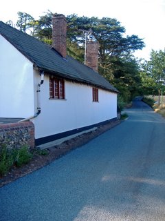
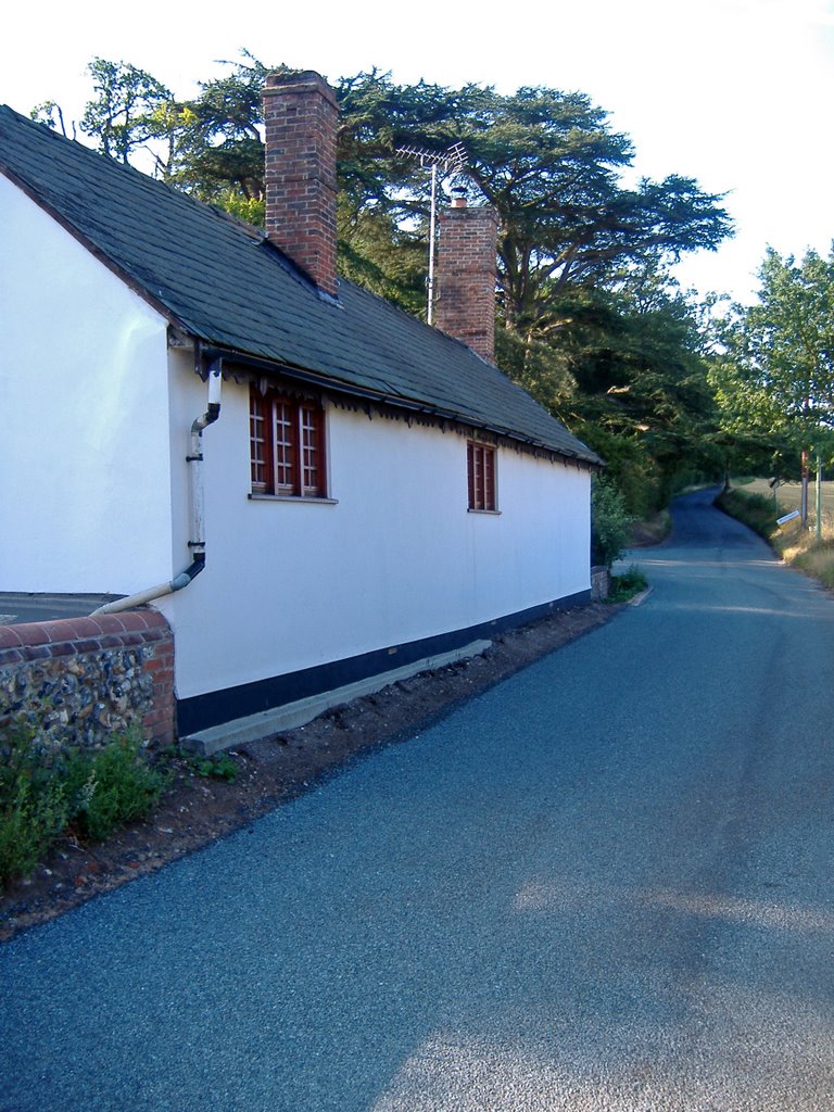
You next run through the small hamlet of Horsecroft which is no more than half a dozen farm houses and some barns. It was once apparently part of the Home farm estate belonging to the Cullum Family. The cottages as seen below are attractive.
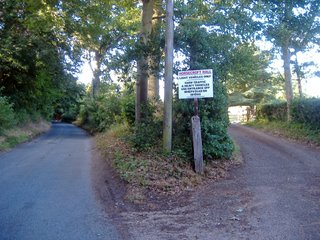
You soon pass Horsecroft Farm and on your left are various paths that can be taken across fields which are part of the Bury to Clare Walk.

To your right is the parish of Horringer, but still continue on the same road.


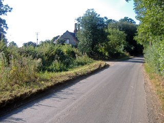
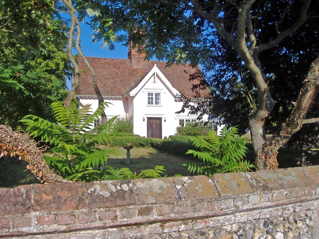
The house below is the on the corner of Park Lane which turns of to the left towards High Green.


You then begin a nice downward section past Hawstead Lodge and at the bottom of the hill arrive in another small hamlet called Pinford End.


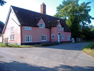
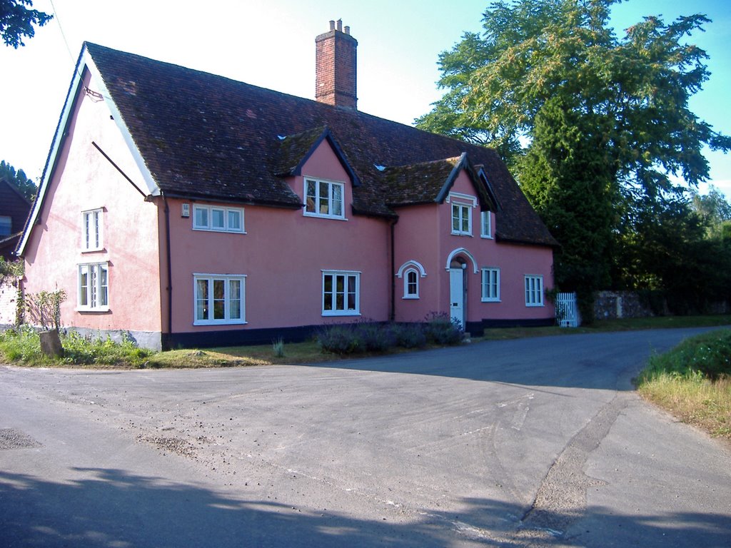
In Pinford there is a lovely Suffolk Pink house ignore the turning to the right and keep to the left past Pinford End Farm.


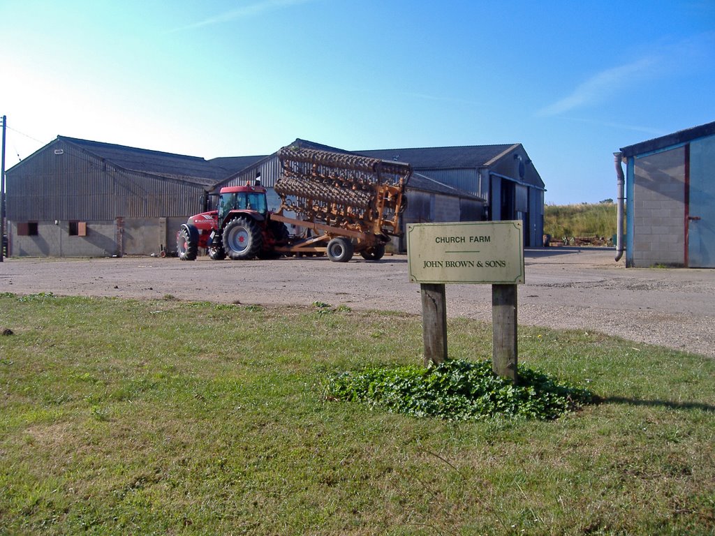
You are now running along Church Road and you soon start to catch glimpses of All Saints Church on your left. Before you reach it on your right you pass Church Farm.


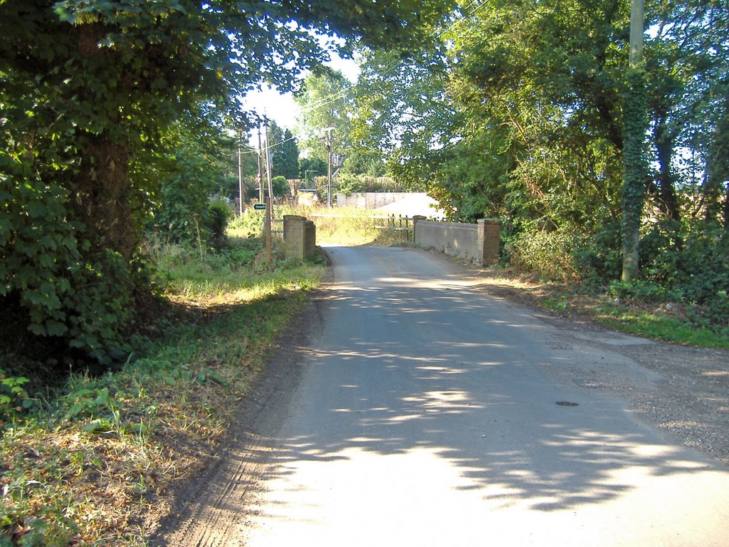
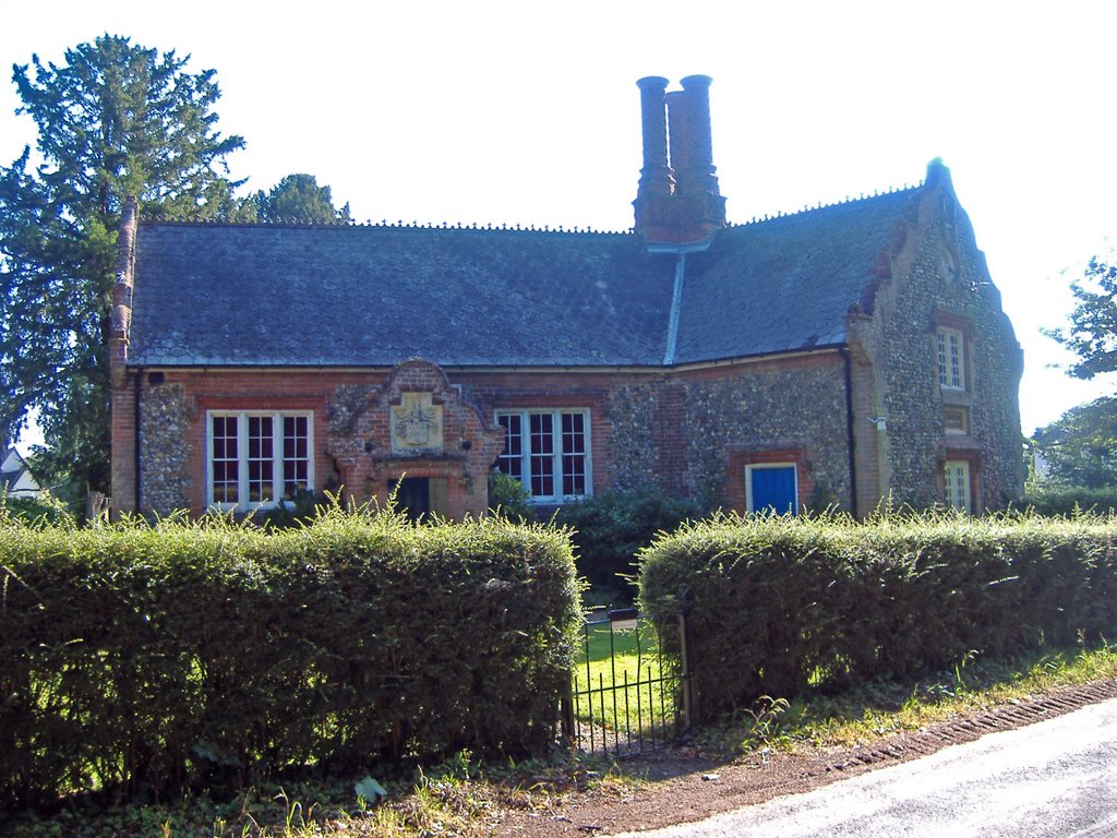
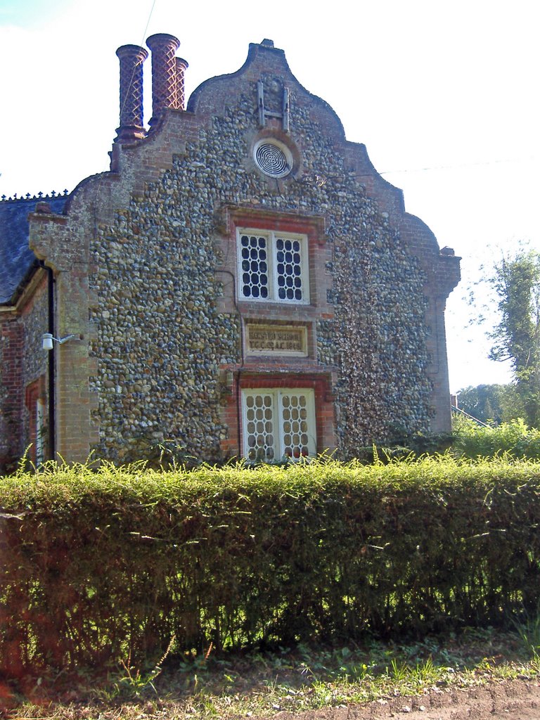
At the end of Church Road you reach a junction and the road to the right takes you into Hawstead and the Green however this run requires you to turn left at the old village school. This is Hawstead village school I note it is currently for sale.


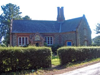
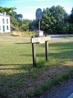
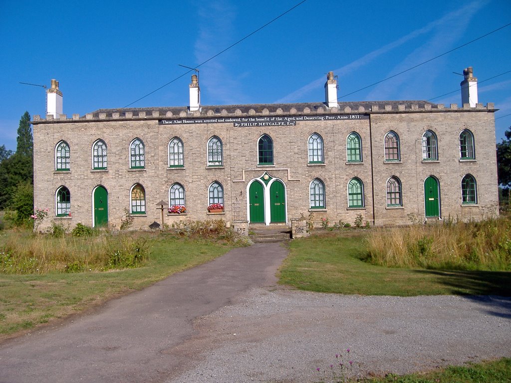
This part of Hawstead is known as Pound Green and on your left you pass the impressive almshouses provided by Philip Metcalfe which were built in 1811 for the deserving poor. I like the big bold sign declaring the importance and generosity of Metcalfe for all to see. I am not sure of his association with Hawstead and whether he is the Metcalfe who was a patron of the arts

, friend of Samual Johnson and an MP for Horsham from 1790 to 1796?

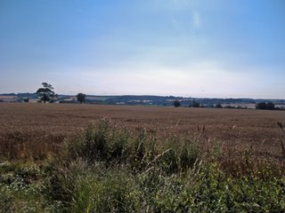
You know begin a fairly steep climb which takes you past Hawstead Hall on the left. There is a minor road to the right which leads to Sicklesmere but ignore the temptation to take a detort and head up hill. You reach the dizzy heights of 79 metres above sea level though this does provide some fantastic views! Over to your left is Nowton and to the right at the bottom of the hill Sicklesmere comes more and more into view.


St Peters Church is about a mile from the vilage of Nowton up this drive.


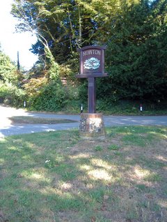
Take the next left at the Nowton village sign as to carry on would lead you onto the busy A134 .


You are now on a path which takes you around the edge of Nowton Country Park. You soon pass
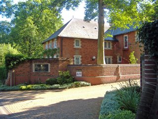
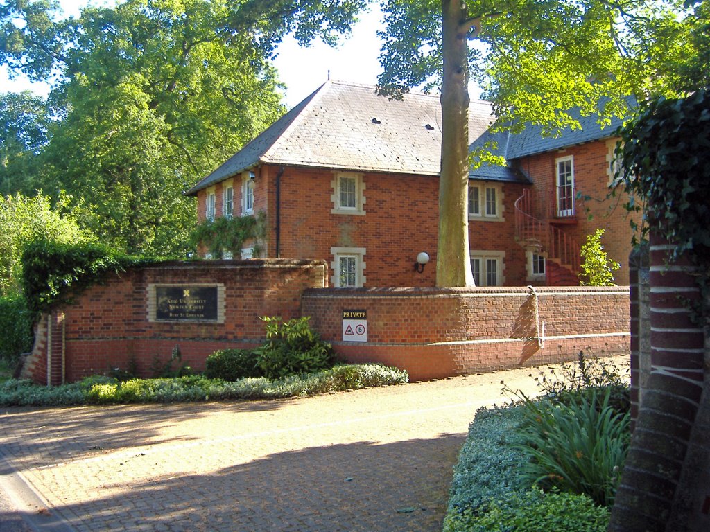
the Keio University It was used as a private home, but in the 20th century, it became a Preparatory School for boys, then a Ladies College for Japanese students, and then passed to Keio University. Keio University is the oldest western style university in Japan.


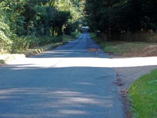
There is no pathway along this stretch so you need to look at for traffic as you are running on the road. However it is often fairly quiet I saw this Muntjac Deer out for a stroll near the Fox and Pin Lane Sign.


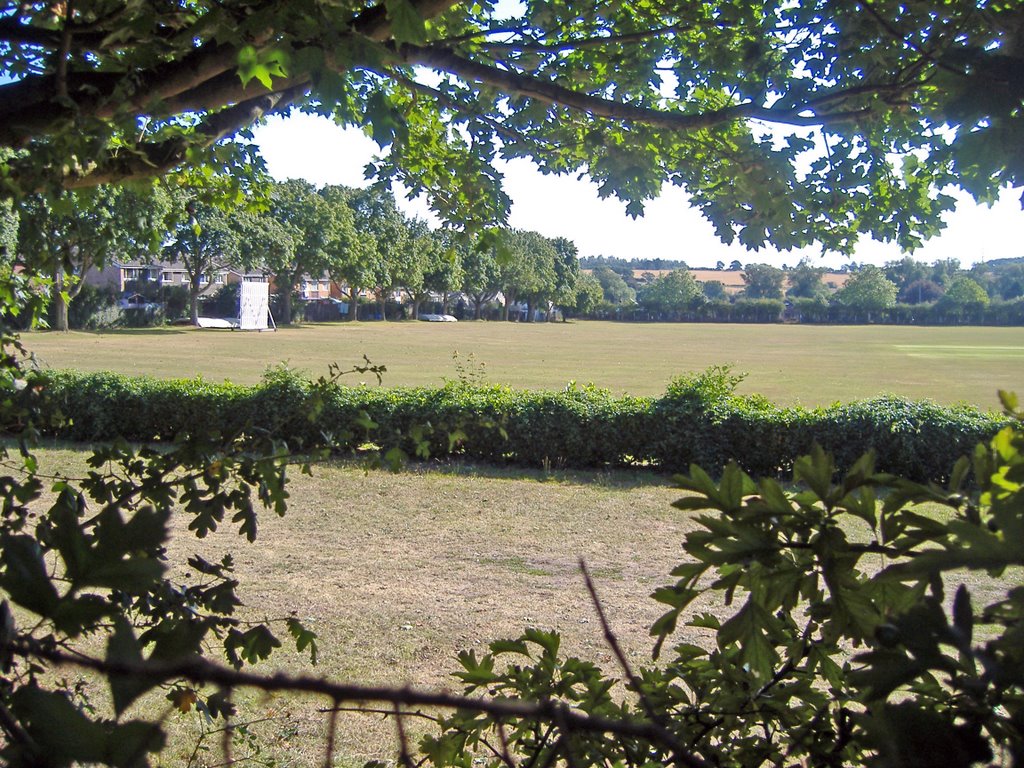
After Nowton Park you come back into Bury and see the Victory Sports Ground on the right.


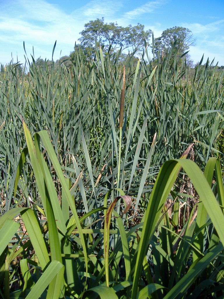
Back into Bury I take the Cullum road into town past the wonderful water meadows. The bull rushes are always a great site.


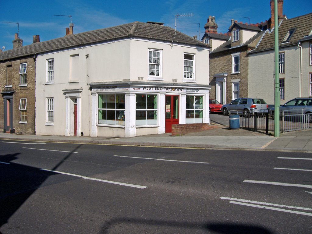
At Out Westgate on the corner is the West End Chip Shop. I can't say I have been in there for many years.


I head along Out Westgate St until I reach the Spread Eagle and then head up Petticoat Lane along Hospital Road and then back up West Road past the cemetery and home.

A satisfying run and a scale of difficulty I would give this a 4 out of 5.
Related Posts with Thumbnails

Running in Suffolk

Share/Bookmark